
Flag Boshielo topographic map
Interactive map
Click on the map to display elevation.
About this map
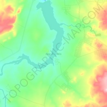
Name: Flag Boshielo topographic map, elevation, terrain.
Average elevation: 891 m
Minimum elevation: 793 m
Maximum elevation: 1,122 m
Other topographic maps
Click on a map to view its topography, its elevation and its terrain.
Marble Hall
South Africa > Limpopo > Sekhukhune District Municipality > Ephraim Mogale Local Municipality
Marble Hall, Ephraim Mogale Local Municipality, Sekhukhune District Municipality, Limpopo, South Africa
Average elevation: 892 m