
Aa küla topographic map
Interactive map
Click on the map to display elevation.
About this map
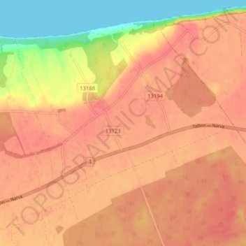
Name: Aa küla topographic map, elevation, terrain.
Location: Aa küla, Aa, Lüganuse vald, Ida-Viru maakond, 30103, Estonia (59.40238 27.13785 59.44238 27.17785)
Average elevation: 42 m
Minimum elevation: 0 m
Maximum elevation: 60 m