
Mkomazi topographic map
Interactive map
Click on the map to display elevation.
About this map
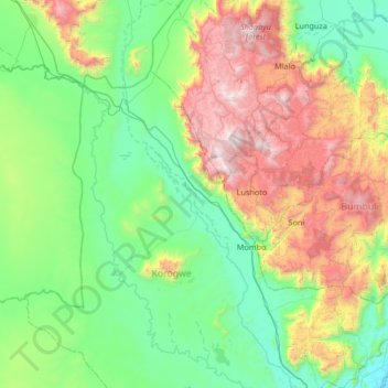
Name: Mkomazi topographic map, elevation, terrain.
Location: Mkomazi, Tanga Region, Northern Zone, Tanzania (-5.13072 38.06549 -4.46572 38.35908)
Average elevation: 864 m
Minimum elevation: 290 m
Maximum elevation: 2,293 m
Other topographic maps
Click on a map to view its topography, its elevation and its terrain.
Mkomazi
Mkomazi, Korogwe, Tanga Region, Northern Zone, Tanzania
Average elevation: 482 m