
Charlottesville topographic map
Interactive map
Click on the map to display elevation.
About this map
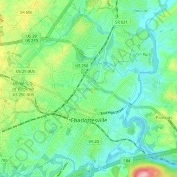
Name: Charlottesville topographic map, elevation, terrain.
Location: Charlottesville, Virginia, USA (38.00962 -78.52367 38.07059 -78.44631)
Average elevation: 138 m
Minimum elevation: 89 m
Maximum elevation: 267 m
Other topographic maps
Click on a map to view its topography, its elevation and its terrain.
James River
James River, Henrico County, Virginia, 23219:23223, USA
Average elevation: 89 m
Mount Hermon
USA > Virginia > Mount Hermon
Mount Hermon, Pittsylvania County, Virginia, USA
Average elevation: 199 m