
Thank you for supporting this site ❤️
Make a donation
Make a donation
Kent County topographic map
Click on the map to display elevation.
Thank you for supporting this site ❤️
Make a donation
Make a donation
About this map
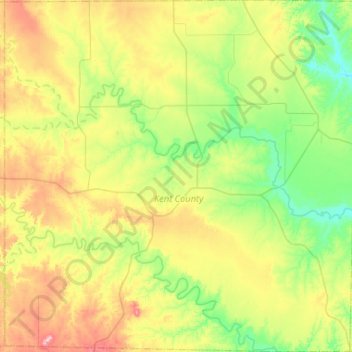
Name: Kent County topographic map, elevation, terrain.
Location: Kent County, Texas, United States of America (32.96293 -101.03884 33.39907 -100.51745)
Average elevation: 646 m
Minimum elevation: 540 m
Maximum elevation: 864 m
Thank you for supporting this site ❤️
Make a donation
Make a donation