
La Retraite topographic map
Interactive map
Click on the map to display elevation.
About this map
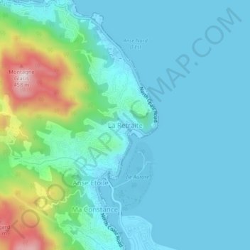
Name: La Retraite topographic map, elevation, terrain.
Location: La Retraite, Mahé, Seychelles (-4.60408 55.44082 -4.56408 55.48082)
Average elevation: 79 m
Minimum elevation: -6 m
Maximum elevation: 438 m