
Thank you for supporting this site ❤️
Make a donation
Make a donation
Ahisamakh topographic map
Click on the map to display elevation.
Thank you for supporting this site ❤️
Make a donation
Make a donation
About this map
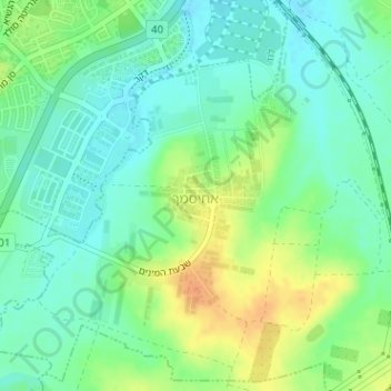
Name: Ahisamakh topographic map, elevation, terrain.
Location: Ahisamakh, Ramla Subdistrict, Center District, Israel (31.92672 34.89948 31.94473 34.91355)
Average elevation: 67 m
Minimum elevation: 53 m
Maximum elevation: 89 m
Thank you for supporting this site ❤️
Make a donation
Make a donation