
Steelpoort topographic map
Interactive map
Click on the map to display elevation.
About this map
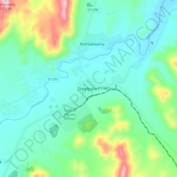
Name: Steelpoort topographic map, elevation, terrain.
Location: Steelpoort, Sekhukhune District Municipality, Limpopo, RSA (-24.77157 30.16565 -24.69157 30.24565)
Average elevation: 854 m
Minimum elevation: 709 m
Maximum elevation: 1,336 m