
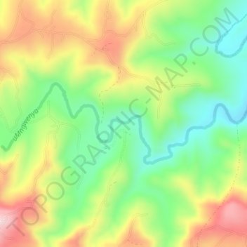
uMngwenya topographic map
Interactive map
Click on the map to display elevation.
About this map
Name: uMngwenya topographic map, elevation, terrain.
Average elevation: 438 m
Minimum elevation: 295 m
Maximum elevation: 624 m
Other topographic maps
Click on a map to view its topography, its elevation and its terrain.
Eshowe
South Africa > KwaZulu-Natal > King Cetswayo District Municipality > uMlalazi Local Municipality
Average elevation: 457 m
Gingindlovu
South Africa > KwaZulu-Natal > King Cetswayo District Municipality > uMlalazi Local Municipality
Average elevation: 66 m