
Matla topographic map
Interactive map
Click on the map to display elevation.
About this map
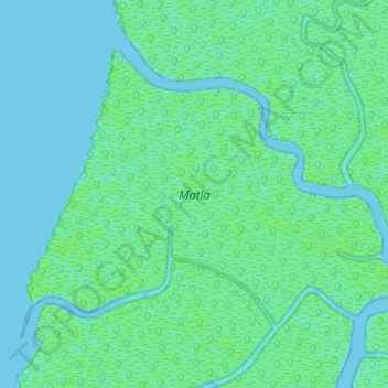
Name: Matla topographic map, elevation, terrain.
Location: Matla, South 24 Parganas, West Bengal, India (21.84969 88.69806 21.90595 88.78022)
Average elevation: 4 m
Minimum elevation: 0 m
Maximum elevation: 9 m
Other topographic maps
Click on a map to view its topography, its elevation and its terrain.
Kolkata
Spread roughly north–south along the east bank of the Hooghly River, Kolkata sits within the lower Ganges Delta of eastern India approximately 75 km (47 mi) west of the international border with Bangladesh; the city's elevation is 1.5–9 m (5–30 ft). Much of the city was originally a wetland that was…
Average elevation: 5 m
Kolkata
India > West Bengal > Kolkata
Spread roughly north–south along the east bank of the Hooghly River, Kolkata sits within the lower Ganges Delta of eastern India approximately 75 km (47 mi) west of the international border with Bangladesh; the city's elevation is 1.5–9 m (5–30 ft). Much of the city was originally a wetland that was…
Average elevation: 5 m
Bardhaman
India > West Bengal > Bardhaman
The region has an average elevation of 40 metres (131 ft). The city is situated 1100 km from New Delhi and a little less than 100 km north-west of Kolkata on the Grand Trunk Road (National Highway 19) and Eastern Railway. The chief rivers are the Damodar and the Banka.
Average elevation: 30 m