
Thank you for supporting this site ❤️
Make a donation
Make a donation
Slangdraai Dam topographic map
Click on the map to display elevation.
Thank you for supporting this site ❤️
Make a donation
Make a donation
About this map
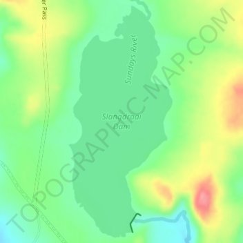
Name: Slangdraai Dam topographic map, elevation, terrain.
Average elevation: 1,322 m
Minimum elevation: 1,286 m
Maximum elevation: 1,381 m
Thank you for supporting this site ❤️
Make a donation
Make a donation
Other topographic maps
Click on a map to view its topography, its elevation and its terrain.
Ezakheni
South Africa > KwaZulu-Natal > Uthukela District Municipality > Emnambithi/Ladysmith Local Municipality
Average elevation: 995 m