
Randfontein topographic map
Interactive map
Click on the map to display elevation.
About this map
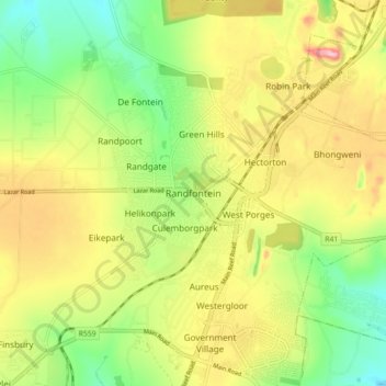
Name: Randfontein topographic map, elevation, terrain.
Average elevation: 1,701 m
Minimum elevation: 1,614 m
Maximum elevation: 1,807 m
Other topographic maps
Click on a map to view its topography, its elevation and its terrain.
Randfontein Local Municipality
South Africa > Gauteng > West Rand District Municipality > Randfontein Local Municipality
Randfontein Local Municipality, West Rand District Municipality, Gauteng, South Africa
Average elevation: 1,617 m