
Thank you for supporting this site ❤️
Make a donation
Make a donation
Marble Hall topographic map
Click on the map to display elevation.
Thank you for supporting this site ❤️
Make a donation
Make a donation
About this map
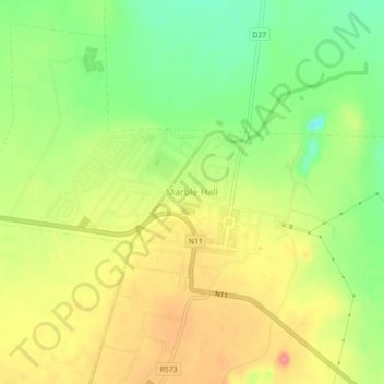
Name: Marble Hall topographic map, elevation, terrain.
Average elevation: 892 m
Minimum elevation: 851 m
Maximum elevation: 931 m
Thank you for supporting this site ❤️
Make a donation
Make a donation
Other topographic maps
Click on a map to view its topography, its elevation and its terrain.
Flag Boshielo
South Africa > Limpopo > Sekhukhune District Municipality > Ephraim Mogale Local Municipality
Average elevation: 891 m