
Bhubaneswar Municipal Corporation topographic map
Interactive map
Click on the map to display elevation.
About this map
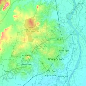
Name: Bhubaneswar Municipal Corporation topographic map, elevation, terrain.
Location: Bhubaneswar Municipal Corporation, Khordha, Odisha, India (20.21127 85.75329 20.36639 85.90340)
Average elevation: 37 m
Minimum elevation: 11 m
Maximum elevation: 134 m