
Susa topographic map
Interactive map
Click on the map to display elevation.
About this map
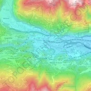
Name: Susa topographic map, elevation, terrain.
Location: Susa, TO, Piemont, 10059, Italy (45.12409 7.03124 45.14533 7.12690)
Average elevation: 926 m
Minimum elevation: 457 m
Maximum elevation: 1,933 m