
Wadgassen topographic map
Interactive map
Click on the map to display elevation.
About this map
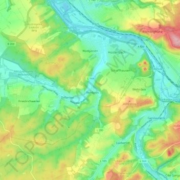
Name: Wadgassen topographic map, elevation, terrain.
Location: Wadgassen, Landkreis Saarlouis, Saarland, 66787, Germany (49.21890 6.71964 49.27410 6.83829)
Average elevation: 229 m
Minimum elevation: 175 m
Maximum elevation: 328 m