
Provincetown topographic map
Interactive map
Click on the map to display elevation.
About this map
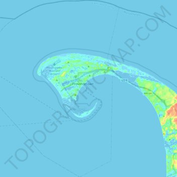
Name: Provincetown topographic map, elevation, terrain.
Average elevation: 1 m
Minimum elevation: -7 m
Maximum elevation: 39 m
Other topographic maps
Click on a map to view its topography, its elevation and its terrain.
Newtown
United States > Massachusetts > Barnstable County > Barnstable
Newtown, Marstons Mills, Barnstable, Barnstable County, Massachusetts, 02648, United States
Average elevation: 26 m