
Sandweiler topographic map
Interactive map
Click on the map to display elevation.
About this map
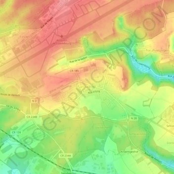
Name: Sandweiler topographic map, elevation, terrain.
Location: Sandweiler, Canton Luxembourg, Luxembourg (49.59961 6.18543 49.63243 6.24029)
Average elevation: 346 m
Minimum elevation: 290 m
Maximum elevation: 387 m