
Prestonfield topographic map
Interactive map
Click on the map to display elevation.
About this map
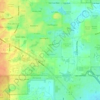
Name: Prestonfield topographic map, elevation, terrain.
Location: Prestonfield, Lake County, Illinois, 60074, USA (42.14391 -88.06091 42.18391 -88.02091)
Average elevation: 235 m
Minimum elevation: 219 m
Maximum elevation: 255 m