
Donmouth Local Nature Reserve topographic map
Interactive map
Click on the map to display elevation.
About this map
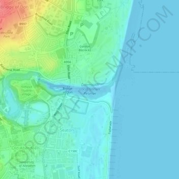
Name: Donmouth Local Nature Reserve topographic map, elevation, terrain.
Average elevation: 14 m
Minimum elevation: 0 m
Maximum elevation: 70 m
Other topographic maps
Click on a map to view its topography, its elevation and its terrain.
Bridge of Don
United Kingdom > Scotland > Aberdeen
Bridge of Don, Aberdeen, Aberdeen City, Scotland, United Kingdom
Average elevation: 44 m