
Taouzient topographic map
Interactive map
Click on the map to display elevation.
About this map
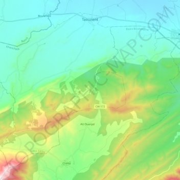
Name: Taouzient topographic map, elevation, terrain.
Location: Taouzient, Kaïs District, Khenchela, Algeria (35.35929 6.62861 35.51798 6.85367)
Average elevation: 1,176 m
Minimum elevation: 872 m
Maximum elevation: 2,143 m