
Apeldoorn topographic map
Interactive map
Click on the map to display elevation.
About this map
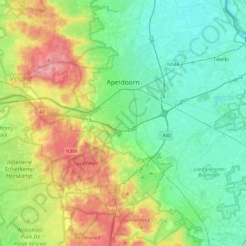
Name: Apeldoorn topographic map, elevation, terrain.
Location: Apeldoorn, Gelderland, Netherlands (52.07334 5.72639 52.28567 6.07848)
Average elevation: 34 m
Minimum elevation: -1 m
Maximum elevation: 110 m