
Iganga topographic map
Interactive map
Click on the map to display elevation.
About this map
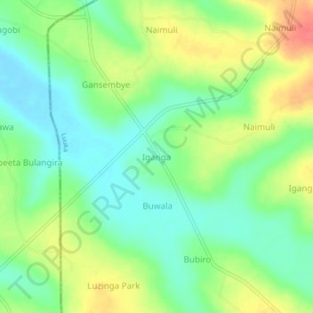
Name: Iganga topographic map, elevation, terrain.
Location: Iganga, Luuka, Eastern Region, Uganda (0.69667 33.21333 0.73667 33.25333)
Average elevation: 1,092 m
Minimum elevation: 1,067 m
Maximum elevation: 1,130 m