
Dwars River topographic map
Interactive map
Click on the map to display elevation.
About this map
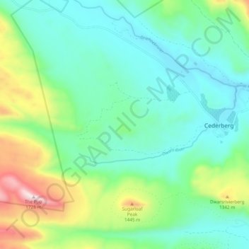
Name: Dwars River topographic map, elevation, terrain.
Average elevation: 1,058 m
Minimum elevation: 832 m
Maximum elevation: 1,708 m
Other topographic maps
Click on a map to view its topography, its elevation and its terrain.
Clanwilliam Dam
RSA > Western Cape > Cederberg Local Municipality
Clanwilliam Dam, Cederberg Local Municipality, West Coast District Municipality, Western Cape, RSA
Average elevation: 135 m