
Cévennes topographic map
Interactive map
Click on the map to display elevation.
About this map
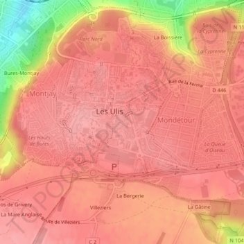
Name: Cévennes topographic map, elevation, terrain.
Average elevation: 148 m
Minimum elevation: 71 m
Maximum elevation: 168 m
Other topographic maps
Click on a map to view its topography, its elevation and its terrain.
Périgord
France > Île-de-France > Essonne > Les Ulis
Périgord, Les Ulis, Palaiseau, Essonne, Île-de-France, France métropolitaine, 91940, France
Average elevation: 145 m
Ventoux
France > Île-de-France > Essonne > Les Ulis
Ventoux, Les Ulis, Palaiseau, Essonne, Île-de-France, France métropolitaine, 91940, France
Average elevation: 154 m