
Cumberland Gap topographic map
Interactive map
Click on the map to display elevation.
About this map
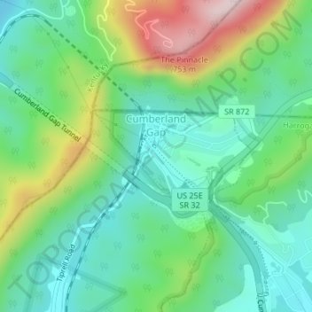
Name: Cumberland Gap topographic map, elevation, terrain.
Location: Cumberland Gap, Claiborne County, Tennessee, USA (36.59288 -83.67501 36.60081 -83.65825)
Average elevation: 490 m
Minimum elevation: 363 m
Maximum elevation: 771 m