
Ubombo Mountain Nature Reserve topographic map
Interactive map
Click on the map to display elevation.
About this map
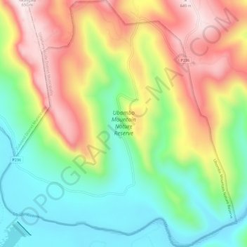
Name: Ubombo Mountain Nature Reserve topographic map, elevation, terrain.
Average elevation: 328 m
Minimum elevation: 88 m
Maximum elevation: 644 m
Other topographic maps
Click on a map to view its topography, its elevation and its terrain.
Mkuze Game Reserve
RSA > KwaZulu-Natal > Jozini Local Municipality
Mkuze Game Reserve, oBhangalala Road, Jozini Ward 20, Jozini Local Municipality, Umkhanyakude District Municipality, KwaZulu-Natal, RSA
Average elevation: 45 m
Jozini Ward 7
RSA > KwaZulu-Natal > Jozini Local Municipality
Jozini Ward 7, Jozini Local Municipality, Umkhanyakude District Municipality, KwaZulu-Natal, RSA
Average elevation: 263 m