
Parua Bay topographic map
Interactive map
Click on the map to display elevation.
About this map
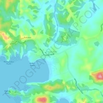
Name: Parua Bay topographic map, elevation, terrain.
Average elevation: 35 m
Minimum elevation: 0 m
Maximum elevation: 157 m
Other topographic maps
Click on a map to view its topography, its elevation and its terrain.
Elgin Place Reserve
New Zealand > Northland > Whangārei District > Whangārei
Elgin Place Reserve, Te Kamo, Whangārei, Whangārei District, Northland, New Zealand
Average elevation: 122 m