
Mookgophong topographic map
Interactive map
Click on the map to display elevation.
About this map
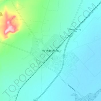
Name: Mookgophong topographic map, elevation, terrain.
Average elevation: 1,115 m
Minimum elevation: 1,077 m
Maximum elevation: 1,319 m
Other topographic maps
Click on a map to view its topography, its elevation and its terrain.
Doorndraai Nature Reserve
South Africa > Limpopo > Waterberg District Municipality > Mookgopong Local Municipality
Doorndraai Nature Reserve, Mookgopong Local Municipality, Waterberg District Municipality, Limpopo, South Africa
Average elevation: 1,250 m