
Moorfield topographic map
Interactive map
Click on the map to display elevation.
About this map
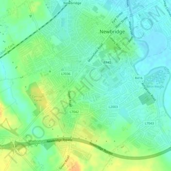
Name: Moorfield topographic map, elevation, terrain.
Average elevation: 97 m
Minimum elevation: 85 m
Maximum elevation: 116 m
Other topographic maps
Click on a map to view its topography, its elevation and its terrain.
Kildare
Kildare, The Municipal District of Kildare — Newbridge, County Kildare, Leinster, Ireland
Average elevation: 103 m