
Kanpur Dehat District topographic map
Interactive map
Click on the map to display elevation.
About this map
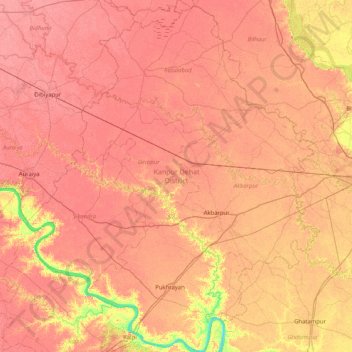
Name: Kanpur Dehat District topographic map, elevation, terrain.
Location: Kanpur Dehat District, Uttar Pradesh, India (26.09010 79.50513 26.82761 80.18974)
Average elevation: 132 m
Minimum elevation: 93 m
Maximum elevation: 147 m
Other topographic maps
Click on a map to view its topography, its elevation and its terrain.
Ganges
India > Uttar Pradesh > Ghazipur
Ganges, Ghazipur, Uttar Pradesh, 233001, India
Average elevation: 1,626 m
Nizamabad
Nizamabad, Azamgarh, Uttar Pradesh, 276305, India
Average elevation: 81 m
Beel Akbarpur
India > Uttar Pradesh > Beel Akbarpur
Beel Akbarpur, Ghaziabad, Uttar Pradesh, 201314, India
Average elevation: 208 m