
Terrenoire topographic map
Interactive map
Click on the map to display elevation.
About this map
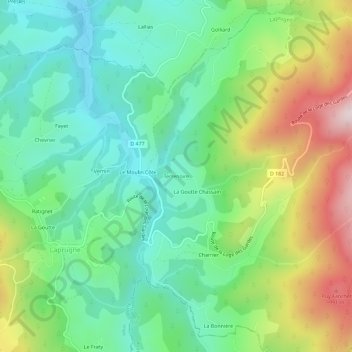
Name: Terrenoire topographic map, elevation, terrain.
Average elevation: 728 m
Minimum elevation: 547 m
Maximum elevation: 1,085 m
Other topographic maps
Click on a map to view its topography, its elevation and its terrain.
Charrier
France > Auvergne-Rhône-Alpes > Allier > Laprugne
Charrier, Laprugne, Vichy, Allier, Auvergne-Rhône-Alpes, France métropolitaine, 03250, France
Average elevation: 762 m