
Cajete topographic map
Interactive map
Click on the map to display elevation.
About this map
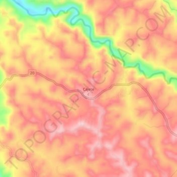
Name: Cajete topographic map, elevation, terrain.
Location: Cajete, Popayán, Centro, Cauca, Colombia (2.45817 -76.69501 2.49817 -76.65501)
Average elevation: 1,712 m
Minimum elevation: 1,566 m
Maximum elevation: 1,776 m
Other topographic maps
Click on a map to view its topography, its elevation and its terrain.