
Thank you for supporting this site ❤️
Make a donation
Make a donation
Houthulst topographic map
Click on the map to display elevation.
Thank you for supporting this site ❤️
Make a donation
Make a donation
About this map
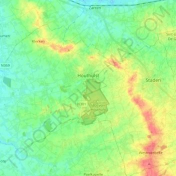
Name: Houthulst topographic map, elevation, terrain.
Location: Houthulst, Diksmuide, West Flanders, Flanders, 8650, Belgium (50.93119 2.80565 51.00841 2.97373)
Average elevation: 18 m
Minimum elevation: -1 m
Maximum elevation: 50 m
Thank you for supporting this site ❤️
Make a donation
Make a donation
Other topographic maps
Click on a map to view its topography, its elevation and its terrain.