
Pousa topographic map
Interactive map
Click on the map to display elevation.
About this map
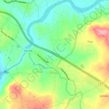
Name: Pousa topographic map, elevation, terrain.
Location: Pousa, Barcelos, Braga, 4755-417, Portugal (41.53883 -8.53338 41.56838 -8.49597)
Average elevation: 62 m
Minimum elevation: 8 m
Maximum elevation: 145 m
Other topographic maps
Click on a map to view its topography, its elevation and its terrain.
Durrães e Tregosa
Durrães e Tregosa, Barcelos, Braga, 4905-152, Portugal
Average elevation: 130 m
Vila Cova e Feitos
Vila Cova e Feitos, Barcelos, Braga, Portugal
Average elevation: 153 m