
Thank you for supporting this site ❤️
Make a donation
Make a donation
DC topographic map
Click on the map to display elevation.
Thank you for supporting this site ❤️
Make a donation
Make a donation
About this map
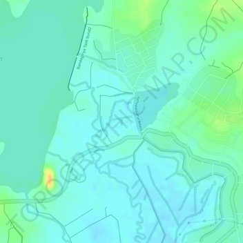
Name: DC topographic map, elevation, terrain.
Location: DC, Hambantota District, Southern Province, Sri Lanka (6.24620 81.15266 6.24693 81.15276)
Average elevation: 24 m
Minimum elevation: 15 m
Maximum elevation: 49 m
Thank you for supporting this site ❤️
Make a donation
Make a donation
Other topographic maps
Click on a map to view its topography, its elevation and its terrain.