
Thank you for supporting this site ❤️
Make a donation
Make a donation
Chénéville topographic map
Click on the map to display elevation.
Thank you for supporting this site ❤️
Make a donation
Make a donation
About this map
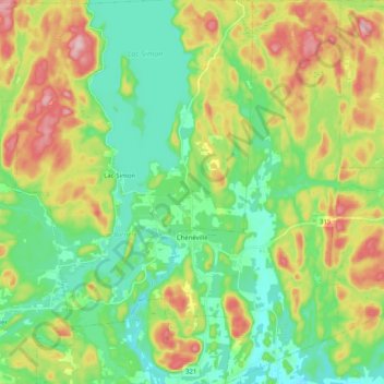
Name: Chénéville topographic map, elevation, terrain.
Location: Chénéville, Papineau, Outaouais, Quebec, J0V 1E0, Canada (45.83267 -75.08291 45.97404 -74.97746)
Average elevation: 249 m
Minimum elevation: 175 m
Maximum elevation: 382 m
Thank you for supporting this site ❤️
Make a donation
Make a donation
Other topographic maps
Click on a map to view its topography, its elevation and its terrain.
Réserve écologique de la Forêt-la-Blanche
Canada > Quebec > Papineau > Mulgrave-et-Derry
Average elevation: 243 m
Thank you for supporting this site ❤️
Make a donation
Make a donation