
Ferreiros topographic map
Interactive map
Click on the map to display elevation.
About this map
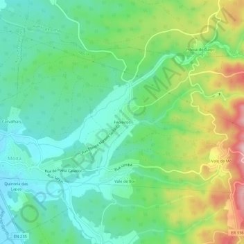
Name: Ferreiros topographic map, elevation, terrain.
Location: Ferreiros, Moita, Anadia, Aveiro, 3780-202, Portugal (40.42910 -8.41348 40.46910 -8.37348)
Average elevation: 118 m
Minimum elevation: 43 m
Maximum elevation: 274 m