
Thank you for supporting this site ❤️
Make a donation
Make a donation
Farmington topographic map
Click on the map to display elevation.
Thank you for supporting this site ❤️
Make a donation
Make a donation
About this map
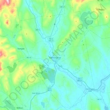
Name: Farmington topographic map, elevation, terrain.
Location: Farmington, Franklin County, Maine, United States (44.58983 -70.22936 44.76036 -70.06578)
Average elevation: 192 m
Minimum elevation: 93 m
Maximum elevation: 620 m
Thank you for supporting this site ❤️
Make a donation
Make a donation
Other topographic maps
Click on a map to view its topography, its elevation and its terrain.