
Braga topographic map
Interactive map
Click on the map to display elevation.
About this map
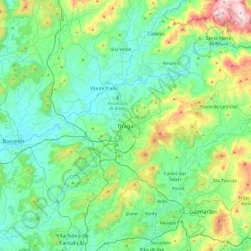
Name: Braga topographic map, elevation, terrain.
Location: Braga, Cávado, Nord, 4700-435, Portugal (41.39106 -8.58800 41.71106 -8.26800)
Average elevation: 204 m
Minimum elevation: 4 m
Maximum elevation: 908 m