
Thank you for supporting this site ❤️
Make a donation
Make a donation
Valencia topographic map
Click on the map to display elevation.
Thank you for supporting this site ❤️
Make a donation
Make a donation
Valencia
The maximum of precipitation occurs in autumn, coinciding with the time of the year when cold drop (gota fría) episodes of heavy rainfall—associated to cut-off low pressure systems at high altitude— are common along the Western mediterranean coast. The year-on-year variability in precipitation may be, however, considerable, as exemplified by large floods in 1957 and 2024, which both occurred in the month of October.
Thank you for supporting this site ❤️
Make a donation
Make a donation
About this map
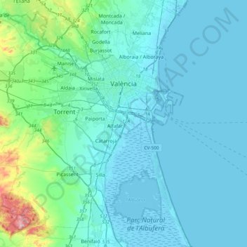
Name: Valencia topographic map, elevation, terrain.
Average elevation: 37 m
Minimum elevation: -6 m
Maximum elevation: 346 m
Thank you for supporting this site ❤️
Make a donation
Make a donation