
Thank you for supporting this site ❤️
Make a donation
Make a donation
Bulwandi topographic map
Click on the map to display elevation.
Thank you for supporting this site ❤️
Make a donation
Make a donation
About this map
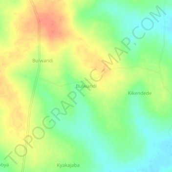
Name: Bulwandi topographic map, elevation, terrain.
Location: Bulwandi, Nakasongola, Central Region, Uganda (1.14831 32.73419 1.18831 32.77419)
Average elevation: 1,064 m
Minimum elevation: 1,040 m
Maximum elevation: 1,089 m
Thank you for supporting this site ❤️
Make a donation
Make a donation