
Usiacuri topographic map
Interactive map
Click on the map to display elevation.
About this map
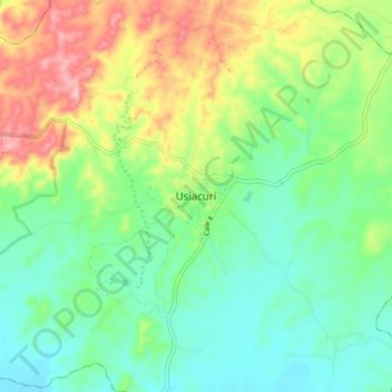
Name: Usiacuri topographic map, elevation, terrain.
Location: Usiacuri, Usiacurí, Atlántico, Colombia (10.70238 -75.01786 10.78238 -74.93786)
Average elevation: 108 m
Minimum elevation: 46 m
Maximum elevation: 227 m
Other topographic maps
Click on a map to view its topography, its elevation and its terrain.