
Runch topographic map
Interactive map
Click on the map to display elevation.
About this map
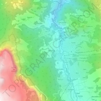
Name: Runch topographic map, elevation, terrain.
Average elevation: 1,633 m
Minimum elevation: 1,208 m
Maximum elevation: 2,525 m
Other topographic maps
Click on a map to view its topography, its elevation and its terrain.
Pedraces
Italie > Trentin-Haut-Adige > Haut-Adige > Badia - Abtei
Pedraces, Badia - Abtei, Pustertal - Val Pusteria, Haut-Adige, Trentin-Haut-Adige, 39036, Italie
Average elevation: 1,614 m