
Itzehoe topographic map
Interactive map
Click on the map to display elevation.
About this map
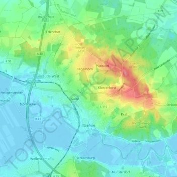
Name: Itzehoe topographic map, elevation, terrain.
Location: Itzehoe, Kreis Steinburg, Sleeswijk-Holstein, 25524, Duitsland (53.90141 9.46971 53.96419 9.57892)
Average elevation: 19 m
Minimum elevation: -4 m
Maximum elevation: 72 m
Other topographic maps
Click on a map to view its topography, its elevation and its terrain.
Bokelrehm
Duitsland > Sleeswijk-Holstein > Kreis Steinburg
Bokelrehm, Amt Schenefeld, Kreis Steinburg, Sleeswijk-Holstein, 25596, Duitsland
Average elevation: 26 m
Horst
Duitsland > Sleeswijk-Holstein > Kreis Steinburg
Horst, Horst-Herzhorn, Kreis Steinburg, Sleeswijk-Holstein, 25358, Duitsland
Average elevation: 5 m