
Hérébo topographic map
Interactive map
Click on the map to display elevation.
About this map
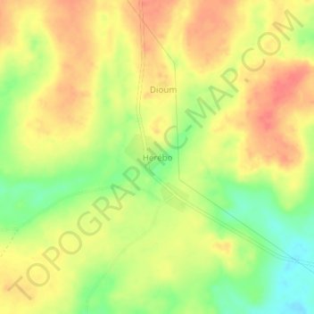
Name: Hérébo topographic map, elevation, terrain.
Location: Hérébo, Gontougo, Zanzan, Côte d’Ivoire (7.93206 -3.07676 7.97206 -3.03676)
Average elevation: 287 m
Minimum elevation: 254 m
Maximum elevation: 309 m
Other topographic maps
Click on a map to view its topography, its elevation and its terrain.
Parc National de la Comoé
Parc National de la Comoé, Bounkani, Zanzan, Côte d’Ivoire
Average elevation: 292 m
Doropo
Côte d’Ivoire > Zanzan > Doropo
Doropo, Bounkani, Zanzan, Côte d’Ivoire
Average elevation: 324 m
Taoudi
Côte d’Ivoire > Zanzan > Taoudi
Taoudi, Gontougo, Zanzan, Côte d’Ivoire
Average elevation: 244 m