
Ballygawley topographic map
Interactive map
Click on the map to display elevation.
About this map
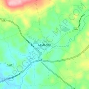
Name: Ballygawley topographic map, elevation, terrain.
Average elevation: 104 m
Minimum elevation: 54 m
Maximum elevation: 221 m
Other topographic maps
Click on a map to view its topography, its elevation and its terrain.
Cullenbrone
Royaume-Uni > Irlande du Nord > Ballygawley
Cullenbrone, Ballygawley, County Tyrone, Irlande du Nord, Royaume-Uni
Average elevation: 65 m
Cavankilgreen
Royaume-Uni > Irlande du Nord > Ballygawley
Cavankilgreen, Tullyvar ED, Ballygawley, County Tyrone, Irlande du Nord, Royaume-Uni
Average elevation: 105 m
Drumcullion
Royaume-Uni > Irlande du Nord > Ballygawley
Drumcullion, Ballygawley, County Tyrone, Irlande du Nord, Royaume-Uni
Average elevation: 65 m