
West Cork topographic map
Interactive map
Click on the map to display elevation.
About this map
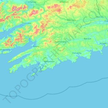
Name: West Cork topographic map, elevation, terrain.
Location: West Cork, County Cork, Munster, Irland (51.38887 -10.30252 51.83673 -8.80738)
Average elevation: 83 m
Minimum elevation: 0 m
Maximum elevation: 971 m
Other topographic maps
Click on a map to view its topography, its elevation and its terrain.
The Municipal District of Kanturk – Mallow
The Municipal District of Kanturk – Mallow, County Cork, Munster, Irland
Average elevation: 182 m
Tullagreen
Irland > County Cork > Municipal District of Cobh
Tullagreen, Carrigtohill ED, Municipal District of Cobh, County Cork, Munster, Irland
Average elevation: 12 m