
Chaville topographic map
Interactive map
Click on the map to display elevation.
About this map
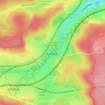
Name: Chaville topographic map, elevation, terrain.
Average elevation: 127 m
Minimum elevation: 57 m
Maximum elevation: 179 m
Other topographic maps
Click on a map to view its topography, its elevation and its terrain.
Saint-Cloud
Frankrijk > Île-de-France > Hauts-de-Seine > Saint-Cloud
Saint-Cloud, Arrondissement de Nanterre, Hauts-de-Seine, Île-de-France, Metropolitaans Frankrijk, 92210, Frankrijk
Average elevation: 71 m