
Haigerbach topographic map
Interactive map
Click on the map to display elevation.
About this map
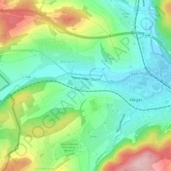
Name: Haigerbach topographic map, elevation, terrain.
Average elevation: 336 m
Minimum elevation: 264 m
Maximum elevation: 474 m
Der Haigerbach entspringt als Ketzerbach etwa 1 km östlich von Willingen am Nordhang der Fuchskaute (657,3 m ü. NHN) auf einer Höhe von 623 m ü. NHN. Er mündet bei Haiger auf einer Höhe von 262 m ü. NHN knapp oberhalb der Aubachmündung in die Dill.